Marokko 4
(28. Januar – 9. Februar 2026)
(Geschrieben von Flinke Feder vom 2. – 10. Februar 2026, redigiert vom grün gefiederten Papageienvogel; dem Ara,)
(Die Red.) Die Solatrike-Reise in Marokko nimmt uns mit am Südende des hohen Atlas entlang und darüber hinweg. Das Reisemagazin «Leise Reisen» begleitet die Abenteuer von El-Kelâa M'Gouna bis nach Ouled boukhalfa.
Morocco 4
(January 28. – February 9. 2026)
(Written by Power Pen from February 2nd – 10. 2026, edited by the green-feathered parrot bird, the macaw)
(The editors) The Solatrike journey in Morocco takes us along the southern edge of the High Atlas Mountains and across them. The travel magazine "Gravel Travel" accompanies the adventure from El-Kelâa M'Gouna to Ouled Boukhalfa."


Keine Kamele
Flinke Feder (FF): Wie viele Kamele hast du gesehen?
David Brandenberger (DB): Gar nicht zahlreiche. Zwei habe ich am Strassenrand fast übersehen und eine kleine Herde weit weg. Ich hoffte, südlich vom Atlas einige Herden anzutreffen, aber gar nix. Da bin ich etwas enttäuscht.
FF: Versprach die Strecke von El-Kelâa M'Gouna aus wenigstens mehr?
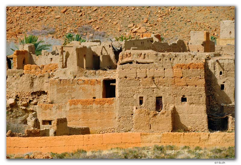
DB: Die Dadès-Schlucht ist das Tal der Rosen. Hier wird Rosenparfüm und Rosenwasser hergestellt. Im Winter blühen keine Rosen. Jede Menge Häuser säumen die Strasse, dazu einige Adoberuinen. Bei Boulmane Dadès legte ich vor dem steilen Aufstieg eine Ladepause ein und mit voller Batterie kroch ich hoch. Oben begeisterte mich das Panorama und kaum war ich aus dem Ort, fand ich mich mitten in der Halbwüste wieder. Bei Imider verschlang ich meinen Lunch und genoss den Anblick der Adobehäuser. Rote Felsen standen links der Strasse und rechts wäre der Fluss, wenn er Wasser führte. An meinem Zielort in Tinghir hatte ich Glück. Beim ersten Hotel, das ich anfragte, konnte ich das Solatrike in die Garage stellen.
FF: Was war das Highlight am nächsten Tag?
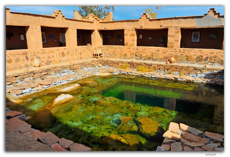
DB: Mitten in der Halbwüste steht das Museum Lalla Mimouna um die Quellen. Der Inhaber Zaid Abbou ist Künstler, Reiseleiter, Autor und Architekt. Er erzählt mir die Geschichte der Quelle und wie er zusätzlich drei andere erschloss. Den ganzen Komplex um die Quellen hat er selbst entworfen, gebaut und ein Museum darin eingerichtet mit unzähligen Artefakten, die er gesammelt und in den Souks erworben hat.
FF: War in Goulmima das Glück dir weiter hold?


53000 km
DB: Das erste Hotel war leer, aber hatte Platz für mich und das Solatrike stellte ich hinter die abgeschlossene Mauer. Der Besitzer wollte weniger Geld, als ich über Booking bezahlt hätte, was mir recht war. Dafür verlangte er für das Abendessen etwas mehr.
FF: Welche Strapazen standen dir vor?
DB: Die Strasse, die aus Goulmima herausführt, leitete mich steil an einer Flanke hoch. Oben genoss ich die Aussicht auf die Palmenoase und pedalte in die Halbwüste. Ein schmucker Tafelberg steht vor dem Eingang zu Errachidia. Dort hatte ich weniger Glück. Das erste Hotel hatte keine sicheren Parkplätze und beim zweiten sollte ich es neben die Türe stellen. Es hätte Wachpersonal und Kameras. Naja, was blieb mir sonst übrig? Da buchte ich gleich für vier Nächte.
FF: Was hat Errachidia zu bieten, dass du so lange bliebst?
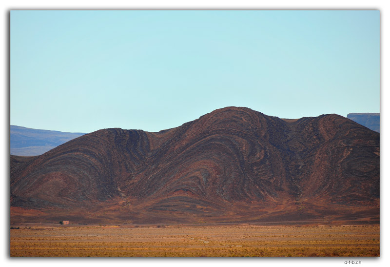
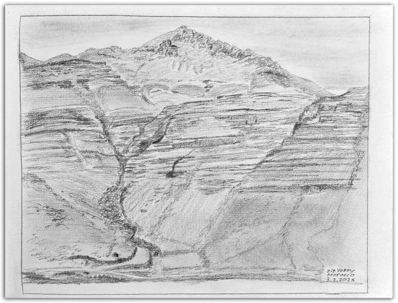
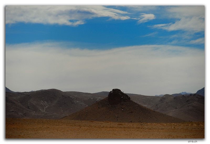
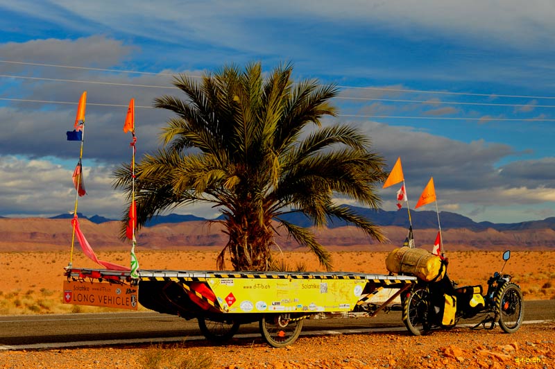
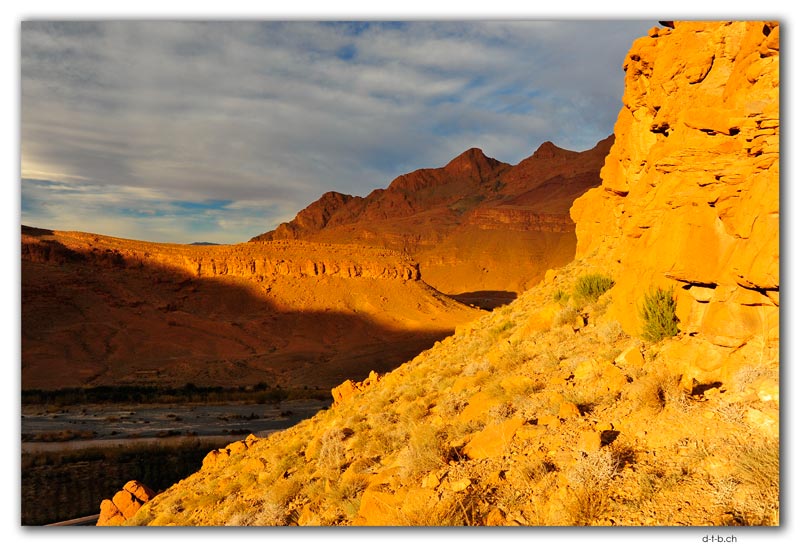
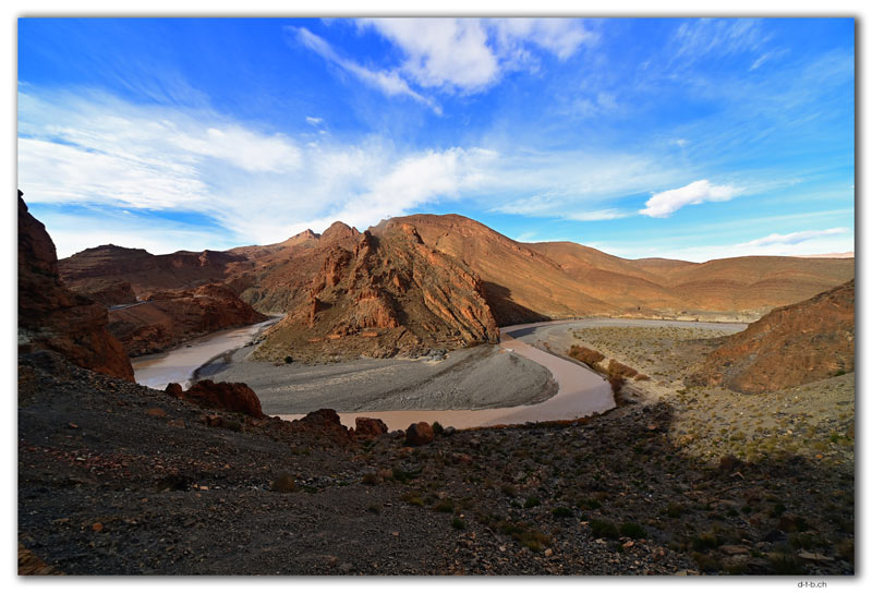
DB: Im Prinzip gar nichts, sogar das Museum ist geschlossen. Ich brauchte eine Pause vom pedalen und nutzte die Zeit, um Arbeiten nachzuholen. Dabei liess ich meine Wäsche reinigen. Ich hatte zweimal das Zimmer zu wechseln. Erst wegen einer defekten Lampe, dann weil kein warmes Wasser aus der Dusche kam. Das Wachpersonal bewachte mein Solatrike nur dürftig und nach der letzten Nacht fehlte die Marokkofahne. Ich weiss nicht, was das soll? In anderen Ländern wurde mir die Landesflagge geschenkt oder gar an den Masten gebunden, hier werden sie mir gestohlen – schon zum zweiten Mal. Zur Sicherheit nahm ich vorausschauend alles Gepäck ins Zimmer, damit mir nicht etwas mehr gestohlen wird. Nach vier Nächten zog ich weiter über einen Pass ins Ziz Tal. Es sieht aus, wie im Grand Canyon mit dem tief eingegrabenen Fluss und Felsflanken deren Gesteinsschichten sich abstufen. Auf dem Weg erreichte ich 53000 km, die ich fast nicht realisierte, da der Tacho fehlt und ich es zusammenrechnen muss.
FF: Wieso bist du nicht weitergefahren nach erst 40 km?
DB: Ich bog zum Hotel ab, damit ich die Gegend erkunden konnte. Nachmittags schnappte ich mir das Skizzenbuch und kraxelte die Flanke hoch dem Weg entlang. Bei einem Felsloch setzte ich mich hinein und Skizzierte die Aussicht. Am nächsten Tag pedalte ich durch das Ziz Tal hinaus und erhaschte dabei anderweitig irrsinnige Ausblicke. Durch ein weites Tal radelte ich durch die trockene Ebene. Bei einer Bio-Farm mietete ich mich per Airbnb ein. Der Weg dahin ist ein rumpeliger Erdpfad. Kurz vor dem Tor blieb ich stecken. Denn der Aufstieg war zu steil und das Rad drehte in den losen Steinen durch. Verzweifelt schlang ich im heftigen Wind mein Mittagessen hinunter.
FF: Bist du genauso durchgedreht oder hast du eine Lösung gefunden?


Windige Strecken
DB: Ich lud die Taschen aus und trug sie hinauf, anschliessend zog ich das fast leere Solatrike aufwärts. Um ein Haar hätte es nicht geklappt und mit einem Ruck schleifte ich es hoch. Kaum waren alle Taschen wieder versorgt, stand ich 50m weiter vor dem geschlossenen Tor. Der Besitzer wies mich per Telefon an, den Schlüssel unter einem kleinen Stein zu suchen. Welchen? Hier sind Millionen kleiner Steine! Ein herbeigerufener Freund fand ihn ebenso wenig, bis wir in der Erde scharrten und da kam der Schlüssel zum Vorschein.
FF: Wie hast du den Nachmittag verbracht?
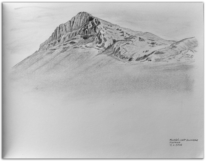
DB: Ich setzte mich mit dem Skizzenbuch in den Windschatten und skizzierte den namenlosen Berg vor mir. Bei der letzten Skizze wurden die Proportionen zu hoch. Das versuchte ich zu vermeiden und diesmal wurden sie zu breit. Der Vermieter des Häuschens traf dazwischen ein und erklärte mir seine Farm, die zurzeit im Aufbau steht. Er selbst wohnt im nahen Ort, wohin er wieder zurückkehrte. Ich beendete die Skizze, liess sie aber unvollendet ohne Vordergrund, da der nicht hübsch anzusehen war und ich genug vom Skizzieren hatte.
FF: Deine nächste Strecke hatte es in sich.
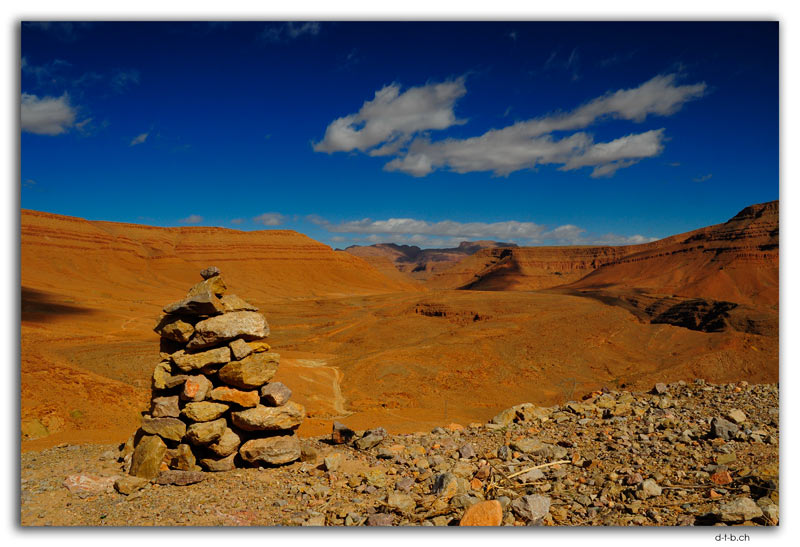
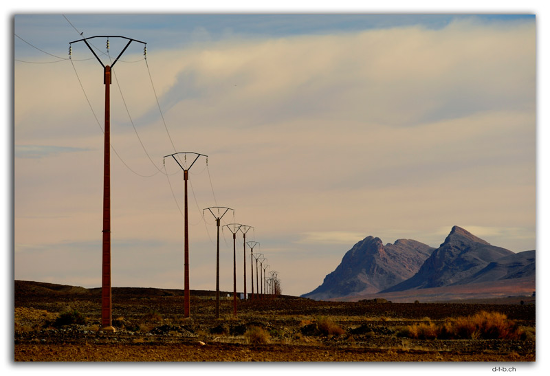
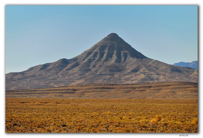
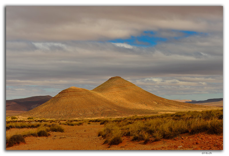
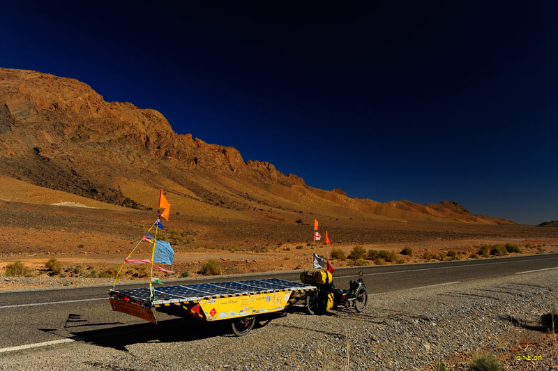
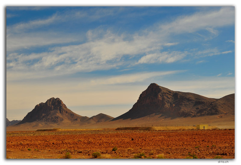
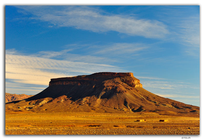
DB: Darum stand ich früh auf, lud alles ein und rumpelte erst über den Ackerweg zur Hauptstrasse. Hinter Gourrama steht ein imposanter Tafelberg, den ich umrundete und auf der rechten Seite erhob sich ein beeindruckender kegelförmiger Berg. Sachte führte die Strasse empor zum Pass und hinten sauste ich wiederum hinunter. Um eine malerische Bergkette folgte die Strasse dem Flusslauf bis Benj Tajjite. Dort bog ich ab und mit einem leichten Gradienten wieder hinauf zum anderen Ende derselben Gebirgsformation. Je länger, desto steiler wurde die Strasse über die Kuppen und die letzten vier Kilometer zogen sich hin, wie Kaugummi. Nach 109 km erreichte ich erstaunt schon um vier Uhr nachmittags Talsint, wo ich in ein Hotel abstieg. Das Solatrike parkte neben der Tanke, die 24h überwacht wird.
FF: Stand die härteste Strecke weiterhin bevor?
DB: Das kannst du laut sagen: Eine 126km lange Tour mit 880 Höhenmeter. Wiederum brach ich früh auf, doch der auf Nachmittag angekündigte Wind blies am Morgen schon. Ich kurbelte mich gegen den intensiven Wind den Berg hoch. Nach 10 km legte ich eine erste Ladepause ein und klammerte mich ans Panel, damit es den Anhänger nicht gleich vom Wind umkippt. Bei der nächsten Strecke nach oben, windete sich die Strasse endlos um die Hügel. Ein Motorradfahrer überholte mich und fragte: «ça va?» (Geht’s gut?) Ich verneinte und der fragte, wieso? Weil es im gewaltigen Gegenwind den Berg hochgeht, das ist kein Zuckerschlecken! Ich fand heraus: Es gibt doch blöde Fragen. Nach 18 km auf einem kleinen Sattel stellte ich die Panels wiederum in die Sonne, um aufzutanken. Der heftige Wind und der grobe Bitumenbelag rauben Energie en masse. Ohne Wind hätte ich eine reale Chance gehabt, die Strecke zu meistern. Allerdings so klappt das nicht.
FF: Hast du aufgegeben?


Gegen den Wind
DB: Vorerst nicht, aber ich freundete mich schon mit dem Gedanken an, dass ich bei leerer Batterie an Ort und Stelle campieren müsse. Bloss wie sollte ich das Zelt aufstellen bei diesem Wind? Ich pedalte hartnäckig weiter und erreichte sechs Kilometer weiter den höchsten Pass auf 1700m. Theoretisch führte die Strasse hinunter, doch der Wind blies so fest, dass ich, ohne beträchtlich zu treten, fast wieder rückwärts den Berg hinaufgeblasen wurde. Unweigerlich folgten weitere Anstiege und ich bog in ein Hochtal ab. Die nächste Ortschaft lag in weiter Ferne und kam nur schleichend näher. Der Wind trocknete meine Lippen aus und mühsam schleppte ich mich durch den Ort.
FF: Legtest du dort eine Pause ein?
DB: Erst plante ich das, indes fand ich keinen Windschattenplatz, daraufhin trat ich weiter kräftig in die Pedalen. Von 1400m beim Ort fing der nächste Aufstieg an, bloss nach 50 Höhenmetern parkte ich das Solatrike. Der Akku war fast leer und für den nächsten steilen Anstieg reichte das nicht. Hier verschlang ich im tobenden Wind meinen Lunch, doch die Batterie liess sich in dieser Stunde kaum laden. Inzwischen war der Himmel wolkenverhangen und die verdeckten die Sonne.
FF: War es trotzdem möglich, weiter zu radeln?
DB: Das bisschen Energie reichte, um den zweiten Pass zu bewältigen. Um zwei Uhr war ich erst bei 55 km und pedalte störrisch gegen den eisigen Wind in das nächste Hochtal. Eine weitere endlose Fahrt bis an dessen Ende ein steiler Aufstieg meinen Akku fast bis aufs Letzte aussaugte. Diesmal blies der Wind entgegen der Panels und die Sonne wurde nur noch von Zirren bedeckt. Es war bereits Viertel nach drei und ich erst bei 68 km.
FF: Überquertest du nicht schon alle Pässe?
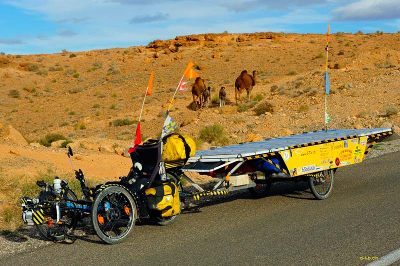
DB: Nur die zwei höchsten. Unzählige kürzere, aber nicht minder steile Aufstiege zehrten an der Energie. Die Strassenführung liess mich an den Strassenbauern zweifeln, denn anstelle über eine niedrigere Stelle, wählten sie einen zusätzlichen Anstieg über einen höheren Pass. Hinten sauste ich letzten Endes etwas hinunter und traute meinen Augen kaum. Mitten im nirgendwo entdeckte ich endlich Kamele am Strassenrand. Ich bremste, doch das Solatrike schob mich weiter. Ich vergass, den Tempomat auszuschalten, und bin am Kamel vorbeigeschossen. Das lief dazu schonmal in Deckung. Sofort schnappte ich die Kamera, damit ich endlich ein Foto mit Trampeltier und Solatrike habe. Nicht perfekt, wie ich es gedachte, aber wenigstens im Kasten.
FF: Hörte der Wind auf zu blasen?


Mit letzten Kräften
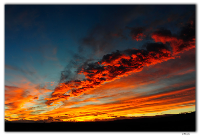
DB: Wo denkst du hin? In der nächsten Ebene blies er von der linken Seite, bis es mir eine Fahnenstange knickte. Nach einem weiteren Dorf versuchte ich abermals ein wenig zu laden, doch der anschliessende Anstieg frass die ganze gewonnene Energie wieder. Der Wind nervte und mir rann die Zeit davon. Nach endlosen Geraden über die Ebene umfuhr ich eine Oase und stellte die Panels erneut. Diesmal von Hand gegen den Wind, da die Sonne tief stand. Jede Menge Energie tankte ich nicht mehr und bei 46,5V pedalte ich weiter. Die Strasse führte unzählige Male in ein Tal und dahinter steil hinauf. Zweimal zog ich das Solatrike am Seil hoch, um etwas Leistung zu sparen. Unterdessen verschwand die Sonne hinter dem Horizont und ein bezauberndes Abendrot leuchtete am Himmel. Ich brauchte aber derzeit weitere 13 km zu pedalen. Ein zermürbender Kampf endet mit der Stirnlampe am Kopf im Dunkeln beim Ort Ouled boukhalfa. Ich buchte eine Unterkunft und fragte Google Maps für den Weg. Diese leitet mich (als Autostrecke) auf einen schiefen Trampelpfad. Dort blieb ich stecken.
FF: Wie bist du da wieder herausgekommen?
DB: Das Hotel rief an und fragte, wo ich sei. Mitten im Dorf, sagte ich, aber ich habe keine Ahnung wo. Gott sei Dank kam ein lokaler Herr hinzu, der den Leuten Anweisungen übermittelte. Zusammen schoben wir das Solatrike rückwärts wieder hoch und die Arbeiter vom Hotel lotsten mich per Auto zur Unterkunft. Die Batterie war nahezu leer, meine Kraft am Ende und trotzdem schaffte ich das fast Unmögliche.
FF: Da hast du dir eine heisse Dusche verdient.
DB: Irgendwie erwische ich jedes Mal ein Hotel ohne heisses Wasser. Dennoch blieb ich mehrere Tage länger, um einige Reparaturen am Solatrike vorzunehmen, mich auszuruhen und den Wind auszusitzen.
FF: Das Abenteuer wird im nächsten Blog weitergeführt.
PDF-Document for download and print.
Passende Links dazu:


No camels
Power Pen (PP): How many camels did you see?
David Brandenberger (DB): Not many at all. I almost missed two by the side of the road and saw a small herd in the distance. I was hoping to encounter a few herds south of the Atlas Mountains, but nothing. I'm a little disappointed.
PP: Did the route from El-Kelâa M'Gouna at least promise more?
DB: The Dadès Gorge is the Valley of Roses. This is where rose perfume and rose water are produced. Roses don't bloom in winter. Lots of houses line the road, along with a few adobe ruins. At Boulmane Dadès, I took a break to recharge my battery before the steep climb, and then crawled up with a full battery. At the top, I was thrilled by the panorama, and as soon as I left the village, I found myself in the middle of the semi-desert. At Imider, I devoured my lunch and enjoyed the sight of the adobe houses. Red rocks stood to the left of the road and to the right would be the river if it had been flowing. I was lucky at my destination in Tinghir. At the first hotel I asked, I was able to park the Solatrike in the garage.
PP: What was the highlight of the next day?
DB: In the middle of the semi-desert, the Lalla Mimouna Museum was built around the springs. The owner, Zaid Abbou, is an artist, tour guide, author and architect. He told me the story of the spring and how he developed three others. He designed and built the entire complex around the springs himself and set up a museum inside it with countless artefacts that he collected and purchased in the souks.
PP: Did luck continue to smile on you in Goulmima?


53,000 km
DB: The first hotel was empty, but had room for me, and I parked the Solatrike behind the locked wall. The owner wanted less money than I would have paid through Booking, which was fine with me. In return, he charged a little more for dinner.
PP: What hardships did you face?
DB: The road leading out of Goulmima took me steeply up a slope. At the top, I enjoyed the view of the palm oasis and cycled into the semi-desert. A pretty Table Mountain stands at the entrance to Errachidia. I was less fortunate there. The first hotel didn't have secure parking and the second wanted me to park it next to the door. It had security guards and cameras. Well, what else could I do? So I booked four nights.
PP: What does Errachidia have to offer that made you stay so long?
DB: Basically nothing, even the museum is closed. I needed a break from cycling and used the time to catch up on some work. I also had my laundry cleaned. I had to change rooms twice. First because of a broken lamp, then because there was no hot water in the shower. The security guards didn't keep a close eye on my Solatrike, and after the last night, the Moroccan flag was missing. I don't know what that's all about. In other countries, I was given the national flag as a gift or even tied it to the flagpole, but here they steal them from me – for the second time already. To be on the safe side, I took all my luggage into my room so that nothing else would be stolen. After four nights, I moved on over a pass into the Ziz Valley. It looks like the Grand Canyon with the deeply carved river and rock flanks whose rock layers are graded. On the way, I reached 53,000 km, which I hardly realised because the speedometer is missing and I have to add it up myself.
PP: Why didn't you continue after only 40 km?
DB: I turned off to the hotel so I could explore the area. In the afternoon, I grabbed my sketchbook and scrambled up the flank along the path. I sat down in a hole in the rock and sketched the view. The next day, I cycled out of the Ziz Valley and caught some other incredible views along the way. I cycled through a wide valley across the dry plain. I rented a room on Airbnb at an organic farm. The road there is a bumpy dirt track. I got stuck just before the gate. The climb was too steep and the bike spun its wheels on the loose stones. Desperate, I wolfed down my lunch in the strong wind.
PP: Did you lose your mind too, or did you find a solution?


Windy roads
DB: I unloaded the bags and carried them up, then pulled the almost empty Solatrike up. It almost didn't work, and I dragged it up with a jolt. No sooner had I stowed all the bags away than I found myself 50 metres further on in front of the closed gate. The owner instructed me by telephone to look for the key under a small stone. Which one? There are millions of small stones here! A friend he called in was just as unsuccessful until we dug around in the earth and the key appeared.
PP: How did you spend the afternoon?
DB: I sat down in the lee with my sketchbook and sketched the nameless mountain in front of me. In the last sketch, the proportions were too high. I tried to avoid that, and this time they were too wide. The owner of the cottage arrived and told me about his farm, which is currently under construction. He himself lives in the nearby village, to which he returned. I finished the sketch, but left it unfinished without a foreground, as it wasn't very pretty to look at and I had had enough of sketching.
PP: Your next stretch was a tough one.
DB: That's why I got up early, loaded everything up and rumbled along the dirt track to the main road. Behind Gourrama stands an imposing Table Mountain, which I circumnavigated, and on the right-hand side rose an impressive cone-shaped mountain. The road gently climbed up to the pass and then I whizzed down again. The road followed the course of the river around a picturesque mountain range to Benj Tajjite. There I turned off and climbed back up the other end of the same mountain range on a slight gradient. The longer I rode, the steeper the road became over the hilltops, and the last four kilometres dragged on like chewing gum. After 109 kilometres, I was surprised to reach Talsint at four in the afternoon, where I checked into a hotel. I parked the Solatrike next to the petrol station, which is monitored 24 hours a day.
PP: Was the hardest part of the route still ahead?
DB: You can say that loud and clear: a 126 km tour with 880 metres of elevation gain. Once again, I set off early, but the wind that had been forecast for the afternoon was already blowing in the morning. I pedalled my way up the mountain against the intense wind. After 10 km, I took my first break to recharge and clung to the panel so that the wind wouldn't knock the trailer over. On the next stretch uphill, the road wound endlessly around the hills. A motorcyclist overtook me and asked, ‘ça va?’ (Are you okay?) I said no, and he asked why. Because climbing the hill in a strong headwind is no walk in the park! I realised that there are indeed stupid questions. After 18 km on a small saddle, I put the panels back in the sun to recharge. The strong wind and rough bitumen surface rob me of a lot of energy. Without the wind, I would have had a real chance of mastering the route. But there's no way I can do it like this.
PP: Did you give up?


Against the wind
DB: Not for the time being, but I was already coming to terms with the idea that I would have to camp on the spot when my battery ran out. But how was I supposed to pitch my tent in this wind? I pedalled on stubbornly and reached the highest pass at 1700 m six kilometres further on. In theory, the road led downhill, but the wind was blowing so fiercely that, without pedalling hard, I was almost blown backwards up the mountain. Inevitably, more climbs followed and I turned into a high valley. The next village was far away and only slowly getting closer. The wind dried out my lips and I laboriously dragged myself through the village.
PP: Did you take a break there?
DB: I planned to, but I couldn't find a place to shelter from the wind, so I kept pedalling hard. The next climb began at 1,400 metres from the village, but after only 50 metres of elevation gain, I parked the Solatrike. The battery was almost empty and wouldn't last for the next steep climb. I wolfed down my lunch in the howling wind, but the battery was barely charging at that point. By then, the sky was overcast and the clouds were blocking the sun.
PP: Was it still possible to continue cycling?
DB: That little bit of energy was enough to get me over the second pass. At two o'clock, I was only at 55 km and pedalled stubbornly against the icy wind into the next high valley. Another endless ride to the end of which a steep climb drained my battery almost completely. This time, the wind was blowing against the panels and the sun was covered by cirrus clouds. It was already quarter past three and I was only at 68 km.
PP: Haven't you crossed all the passes yet?
DB: Only the two highest ones. Countless shorter but no less steep climbs sapped my energy. The route made me question the road builders, because instead of taking a lower route, they chose an additional climb over a higher pass. In the end, I whizzed down the back a little and could hardly believe my eyes. In the middle of nowhere, I finally spotted camels by the side of the road. I braked, but the Solatrike kept pushing me forward. I forgot to turn off the cruise control and shot past the camel. It ran for cover. I immediately grabbed my camera so I could finally take a photo with a camel and the Solatrike. Not perfect, as I had imagined, but at least I got the shot.
PP: Did the wind stop blowing?


On the edge
DB: What are you thinking? On the next plain, it blew from the left until it knocked down a flagpole. After another village, I tried to charge a little again, but the subsequent climb ate up all the energy I had gained. The wind was annoying and I was running out of time. After endless straights across the plain, I drove around an oasis and set up the panels again. This time by hand against the wind, as the sun was low. I didn't recharge much energy and pedalled on at 46.5V. The road led into a valley countless time and then steeply uphill behind it. Twice I pulled the Solatrike up with a rope to save some power. Meanwhile, the sun disappeared behind the horizon and an enchanting sunset glowed in the sky. But I still had another 13 km to pedal. A gruelling battle ended with my headlamp on in the dark near the village of Ouled Boukhalfa. I booked accommodation and asked Google Maps for directions. It directed me (as a car route) onto a crooked footpath. I got stuck there.
PP: How did you get out of there?
DB: The hotel called and asked where I was. In the middle of the village, I said, but I had no idea where. Thankfully, a local gentleman arrived and gave the people instructions. Together, we pushed the Solatrike backwards up the hill and the hotel workers drove me to my accommodation. The battery was almost empty, my strength was at an end, and yet I managed the almost impossible.
PP: You deserved a hot shower.
DB: Somehow, I always end up in hotels without hot water. Nevertheless, I stayed several days longer to make some repairs to the Solatrike, rest and wait out the wind.
PP: The adventure continues in the next blog.
Word-Document for download and print.
Related Links:


Write a comment
Kurt Hostettler (Thursday, 05 March 2026 16:42)
Ja Hallo David, einmal mehr faszinierende Landschaftszüge und Bilder die du jeweils einbeziehst.
Du bist ja nimmermüde, wenn ich so alles gelesen habe, muss du unbedingt noch die Höhenmeter auch dazu berechnen, dann hast du wahrscheinlich schon über 20000 Höhen - Meter ab geradelt.
Danke für deinen Hinweis in Sachen Bargeld von Marrakech!
So wünsche ich dir von Herzen weiterhin viel Freude und Spass.
Es liabs Grüässli
Kurt